

At Riverton in Fremont County, DNR crews pump river water onto the marsh each fall to hold migrating ducks.
Pumped marsh is only as reliable as the river feeding it, so the water you find can change from season to season. Iowa DNR publishes a wetland habitat conditions report through the fall, and it helps you choose between a boat tract and a walk-in tract.
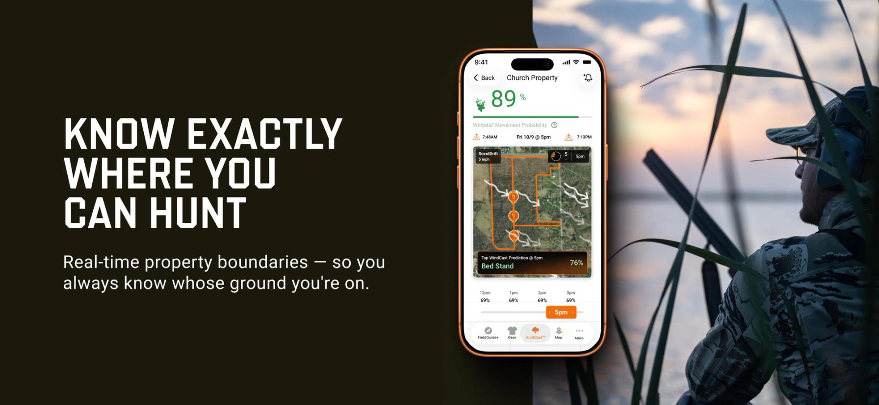
HuntWise puts those WMAs on your phone before you drive out. Our public land layer outlines each area on satellite imagery, so you can pin your access point from home. If you're new to locating public hunting land, the basics carry over to every state, and this guide covers the steps, key areas, and posted refuges.
How to Find Public Waterfowl Hunting Land in Iowa: Five Steps
Iowa's pumped marshes fill on the DNR's schedule, so the order of these steps matters more than usual.
- Turn on the public land layer in HuntWise. Open HuntWise mapping tools, enable the public land layer, and scroll to the southwest corner of the state. WMA boundaries appear over satellite imagery, showing how the marsh, levees, and river relate to each other.
- Compare the tracts at Riverton. The Larsen Tract is the main boat area north of County Road J46, the Johnson Tract is a walk-in area on the north marsh, and the Jensen Tract lies south of the road. Choose the one that matches your hunting style.
- Read the DNR habitat report. The DNR wetland habitat conditions report lists water levels and access notes for each wildlife unit, including the Nishnabotna Wildlife Unit that covers Riverton. Check it again before your trip, because pumping can lag behind the calendar.
- Confirm your season, zone, and shooting hours. Iowa splits duck seasons by zone, and the Iowa DNR waterfowl season dates cover the special September teal season and the regular segments. Legal hours start half an hour before sunrise and end at sunset, except during September teal, when they run from sunrise to sunset.
- Mark the refuge lines before you set up. DNR posts refuge segments at Riverton and many other marshes, and hunting ducks and geese inside them is unlawful while they're posted. Trace those lines on your map so you know where to stop.
Iowa DNR's Where to Hunt page explains the interactive hunting atlas, which maps lands open to public hunting across the state.
What to Pack and Confirm Before You Hunt Iowa Marshes
Water levels and weather change where ducks sit, so plan your trips around when to hunt ducks and the pump schedule. Most hunters carry the same core items:
- An Iowa hunting license, the habitat fee, and the state migratory game bird fee, plus a Federal Duck Stamp (sold as an e-stamp) and annual Harvest Information Program (HIP) registration
- Waders for walk-in tracts and a shallow-water boat or layout boat for boat areas
- Decoys you can pick up each evening, since Iowa limits how long they can sit unattended on game management areas
- A downloaded HuntWise hunt area with pins on your parking spot, boat ramp, and refuge boundary
Pumped marshes fill in stages, so scout your ramp or access trail a few days before the opener whenever you can.
Waterfowl Hunting Areas in Iowa
Five marshes across the state give you a starting list, from the Missouri River bottoms to the northeast corner. Iowa DNR runs all of them as WMAs, so a quick read on hunting on WMAs helps you know what to expect.
Iowa Waterfowl Hunting Areas | |
|---|---|
| Area Name | Rules |
| Riverton WMA (Fremont County) | DNR pumps river water onto the marsh each fall. The Larsen Tract serves boats, the Johnson Tract is walk-in, and the Jensen Tract sits south of County Road J46. Posted refuge segments are closed to duck and goose hunting. |
| Big Marsh WMA (Butler County) | Several managed pools and sub-impoundments hold water at different levels. Some parts of the area are designated as a waterfowl refuge, so check the DNR conditions report before you choose a pool. |
| Elk Creek Marsh (Worth County) | Three managed pools, labeled A, B, and C, flood gradually during the fall. The DNR hunting atlas shows the waterfowl refuge boundary on Pool B. |
| Cardinal Marsh (Winneshiek County) | The Main Marsh offers boat access, and segments A through D are mainly walk-in. Boat size and motor type can limit how far you travel through the vegetation. |
| Green Island WMA (Jackson County) | This Mississippi River bottoms area relies on DNR pumps to manage water. Part of the area is a posted waterfowl refuge. |
How a Hunting App Helps You Read a Pumped Marsh
A pumped marsh looks different from year to year, so satellite imagery earns its keep beyond boundaries. In HuntWise, you can see where the levees, ditches, and open water sit, then match that picture to the DNR report to decide which tract is worth the drive.
Iowa is mostly farmland, so WMAs often sit beside private cropland, and reading property lines before you walk a dike keeps you on public ground. Download your hunt area at home so the map loads at the ramp, because most WMAs offer only basic parking and boat ramps.
Finding Public Waterfowl Hunting Land in Iowa Is Easier with HuntWise
Public waterfowl hunting in Iowa rewards hunters who treat water as a moving target. Read the DNR report, pick the tract that fits your gear, learn where the posted refuges start, and confirm your zone's season before you load the truck.
HuntWise lays out each area ahead of time, so you can arrive at the marsh already knowing where public ground begins and ends.
Frequently Asked Questions (FAQs)
Q: What is the best public waterfowl hunting land in Iowa?
A: Public waterfowl hunting land in Iowa runs from Riverton in the southwest to Cardinal Marsh in the northeast, and the right fit depends on whether you prefer a boat tract or a walk-in tract. Riverton is a popular choice in the Missouri River bottoms, while marshes such as Big Marsh and Elk Creek give you options farther north.
Q: How does Iowa DNR manage water levels at Riverton Wildlife Area?
A: Iowa DNR manages water levels at Riverton with pumps that draw from the East and West Nishnabotna Rivers, and the usual pumping season starts in mid-August. River flows and repair projects can limit pumping, so crews sometimes fill the boat area, walk-in area, and refuge in a different order each year.
Q: Do I need to check in before hunting Riverton Wildlife Area?
A: You don't need a reservation or drawing to hunt Riverton, but you should follow any check-in instructions posted at the area. Look at the signs at the parking lots and boat ramps, and ask the DNR's Nishnabotna Wildlife Unit before opening day if you want confirmation.
Q: Is access to Riverton Wildlife Area first-come or by permit?
A: Access to Riverton Wildlife Area is first-come, and general waterfowl hunting there doesn't use a permit drawing. You still need your standard Iowa waterfowl license, fees, Federal Duck Stamp, and HIP registration.
Q: How many acres of WMA land does Iowa DNR manage?
A: Iowa DNR manages more than 410,000 acres of Wildlife Management Areas, and all of them stay open for public recreation every day of the year. The DNR hunting atlas covers even more ground, adding county areas, Army Corps lands, and enrolled private land.
Q: Can HuntWise show me Iowa's managed marsh boundaries?
A: HuntWise shows Iowa's managed marshes through its public land layer, which outlines each WMA on satellite imagery. For pump schedules, tract names, and posted refuge lines, check the DNR hunting atlas and conditions report, since those details change by season.
Q: What waterfowl species use Riverton Wildlife Area?
A: Riverton holds ducks through the fall, including blue-winged teal early in the season and mallards later on. In strong years, DNR staff have counted 30,000 to 50,000 ducks at the peak, usually around November.
Q: How do I download Iowa WMA boundaries for offline use?
A: To download Iowa WMA boundaries for offline use, set up a hunt area around the WMA in HuntWise and save it over Wi-Fi before you leave home. Your boundaries and pins stay loaded at a remote boat ramp, even when the signal drops.


