

- Saddles are low crossings along a ridge between higher points, often providing an easier travel route through the terrain, sometimes associated with drainages or creek crossings.
- Benches are flat, shelf-like terrain on steep hillsides, often used for bedding. They offer a low-effort travel line across the slope and are favored for their visibility and escape routes into hollows or side slopes.
- Pinch points funnel movement, such as land bridges, ridge gaps, and field edges that pinch into timber.
These three features show up as distinct contour patterns in the HuntWise topo overlay. Once you know how to read one, whether you're looking for saddles on topo maps or pinch points near an agricultural field, you can plan smarter, select better stands, and use the terrain to your advantage.
Keep reading as we explore these features below, what they mean for deer movement, and why you need a topo map app.
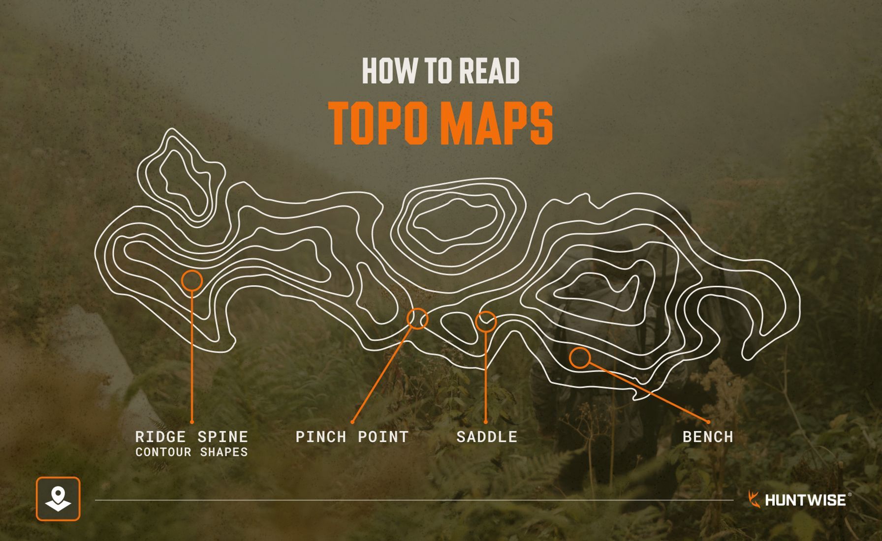
What Each Terrain Feature Means for Deer Movement
Before identifying deer travel routes on the map, take a closer look at terrain features and how deer use them across the landscape. Mastering topo maps doesn't take much, since the terrain features above account for most deer movement. Let's take a closer look at what they are and why deer use them before exploring what they look like on your app.
SaddlesSaddles are dips in a ridge or low points between two ridges. For deer, this is the easiest way to cross without climbing up over a peak and wasting unnecessary energy. They create a natural travel corridor connecting key features, such as two drainages or two patches of cover. Saddles concentrate movement into a predictable crossing rather than deer spreading out across the entire ridgeline. Saddles lined with dense vegetation are highly productive, especially for mature bucks that limit their daylight exposure. From a hunting perspective, saddles are popular hunting locations, so target saddles in deep territory other hunters may overlook, especially when hunting public land. Saddles on topo maps are typically described as hourglass-shaped. | 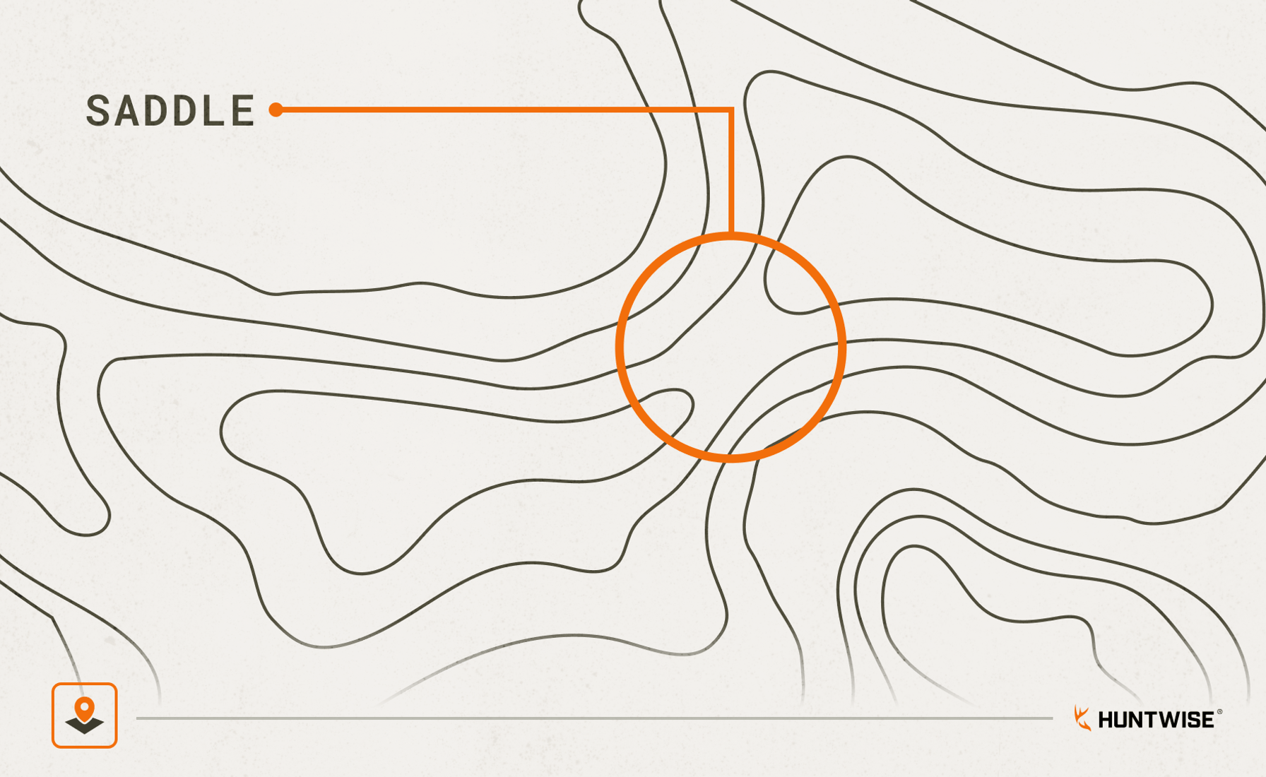 |
BenchesBenches are flat or gently sloped landings on steep hillsides where deer like to bed. More than just a place to rest, benches sit two-thirds to three-quarters up a slope, offering visibility below and quick escape routes above and to the sides. The higher up the bench, the more likely it is to see daylight movement than on the lower benches. You don’t have to scout on foot to know that benches visible on topo maps are some of the most reliable indicators of bedding areas. | 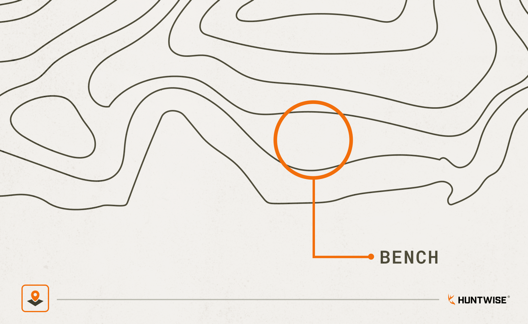 |
Pinch PointsWhile pinch points and funnels share many similarities, pinch points are a narrow linking segment where deer have no choice but to push through. These may be a land bridge between wetlands, a gap in a ridgeline, or a field edge squeezing into timber. They differ from saddles because pinch points form in any narrowing terrain, not just at low elevations like a ridge-top low spot. Deer are typically “pinched” when the terrain on either side is too difficult or doesn’t offer enough cover to move through. Common examples of a pinch point on topo map include creek beds, property lines, habitat edges, or gaps in fences. Pinch points make elite ambush-hunting locations, especially where several funnels join. | 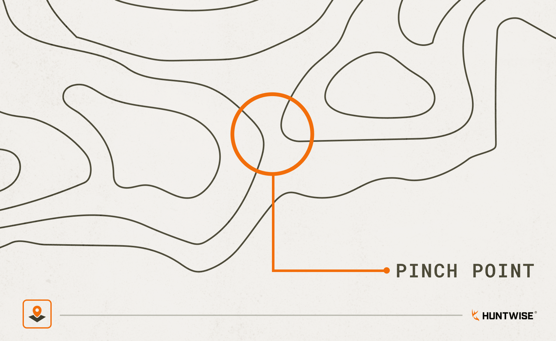 |
Ridge SpinesRidge spines, often called ridge lines, are the peaks where two edges meet to form a ridge crest. On a topo map, they look like a convex run of contours that follows the ridge crest. While they commonly serve as bedding areas, deer also travel the spine as it's the simplest route when covering high ground. Bucks scent-check it during pre-rut for rub lines and scrapes, so when pre-rut kicks off, this is a strong stand placement option for ridge-heavy movement and activity. | 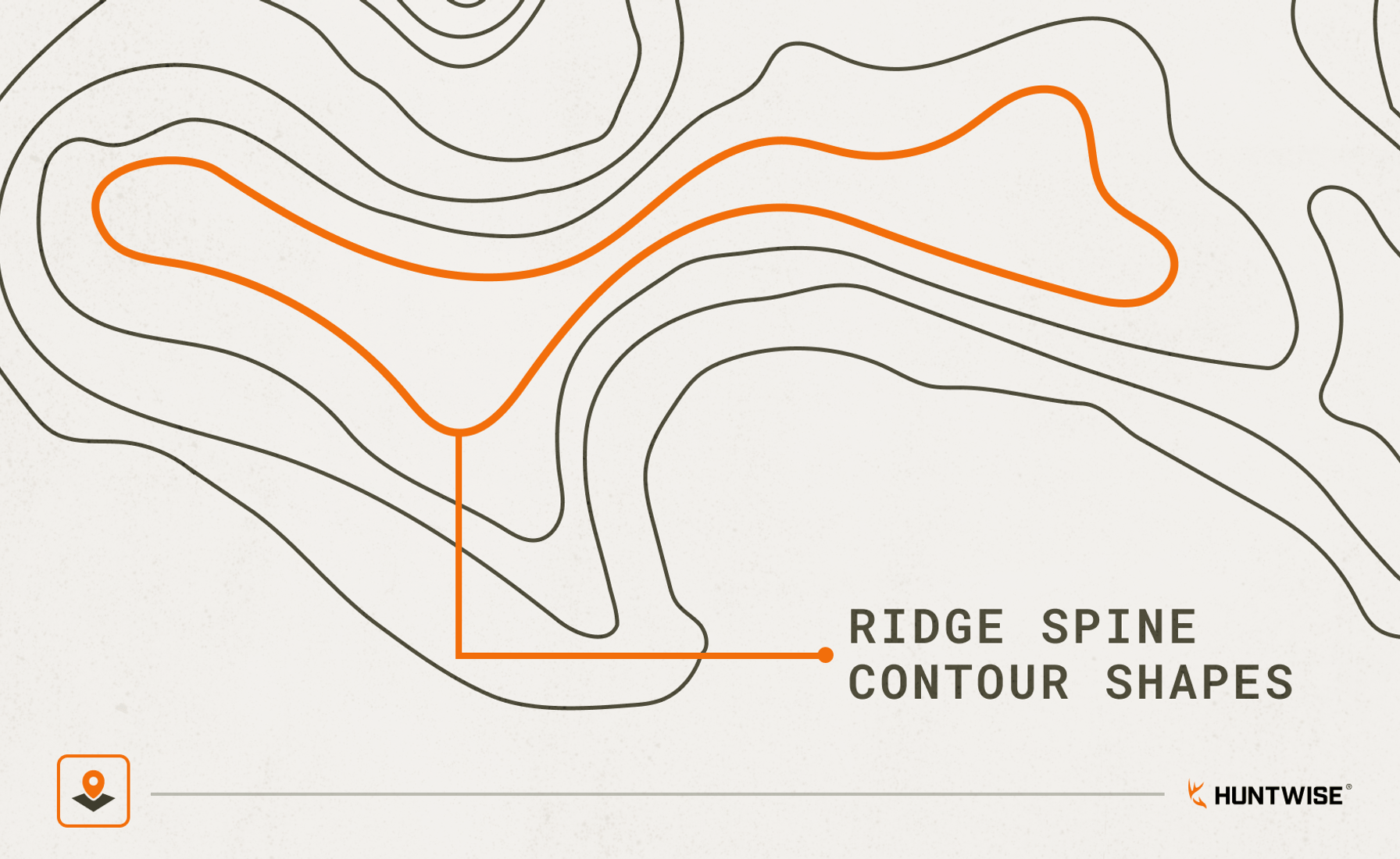 |
Thermal HubsA thermal hub on topo map is an essential landmark to acknowledge when planning approaches. Thermal hubs are where thermal air currents from several directions converge and swirl. Cross into one, and you risk getting winded, as these sites can blow thermals in unpredictable directions you may not have accounted for. On the map, they look like a bowl-shaped depression or a point where multiple drainages or ridge endings meet. Now that you have an idea of what each feature looks like and why deer use it, let’s take a closer look at how to find pinch points on a topo map and other key landmark features. | 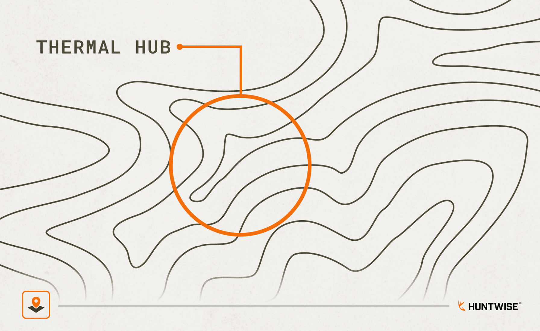 |
How to Find Benches, Pinch Points and Saddles on Topo Maps
Use these steps as a reliable e-scouting procedure to identify high-probability terrain features you can use on any new property or public land before scouting in person. Even if you’re new to the HuntWise app, these steps can get you to quality hunting locations with ease.
- Open HuntWise: After selecting your hunting area, open the HuntWise satellite + topo hybrid view.
- Look for saddles: A topo map saddle looks like an hourglass or a figure-8 in the contours between two ridges. Set a marker on the downwind side of a saddle for a high-probability stand location.
- Look for benches: A bench on topo map shows contours that spread out at a mid-slope elevation. These flat zones amongst slopes are common bedding areas. In the morning, set up on the high side as thermals rise. For a late-afternoon hunt, stay low.
- Look for pinch points: Features such as wetlands, creek bottoms, field edges, and property corners should funnel deer into narrower sections between two low features. Set up on the downwind side of these hunting lines.
- Look for thermal hubs (hilly terrain only): These are points where several drainage points converge, causing thermals to swirl. Note these when planning an approach, as they affect air movement and animal scent checking and act as focal points for rising and falling air. These are typically described as a “crow's foot” style contour where three or more distinct convergences join.
- Mark waypoints: After marking suitable terrain features, use your HuntWise map to mark waypoints for infield scouting and stand selection.
Use the steps above as part of your first-step scouting flow. Once you’ve marked potential scouting and stand areas, head out into the field for boots-on-the-ground confirmation.
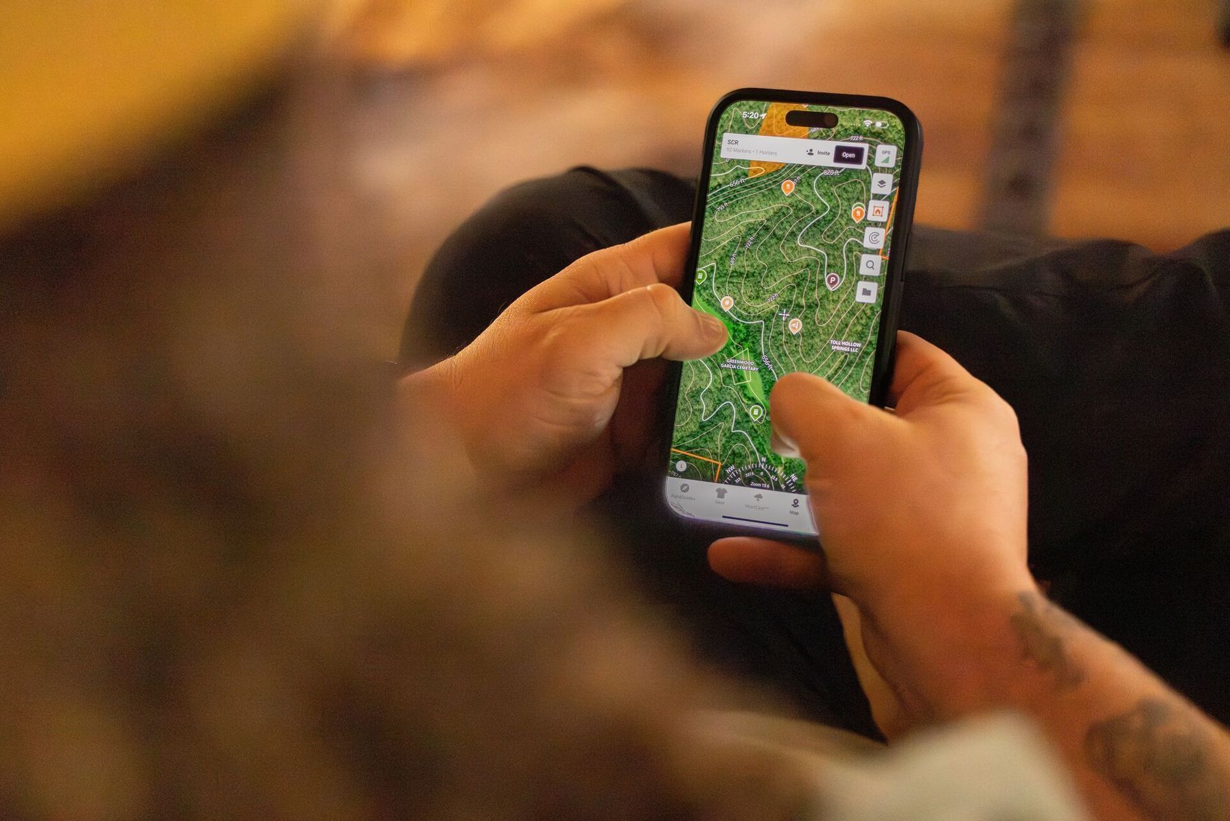
Terrain Features in HuntWise: Identification and Hunting Application
Scouting land doesn't have to wait until hunting season. Start scouting today to get familiar with terrain features and how they appear on the map. Once you’re familiar with the topography, use the resource below to match the topographical feature to the in-field hunting strategy.
Terrain Features in HuntWise | |||
|---|---|---|---|
| Feature | Topo appearance | Why deer use it | Best hunting phase |
| Saddle | Hourglass between two high points | Travel corridor across ridge | Seeking and peak chasing |
| Bench | Wide spacing mid-steep slope | Bedding (visibility and escape) | Lockdown and early morning |
| Pinch point | Narrow high ground between lows | Forced movement corridor | Peak chasing (all day) |
| Ridge spine | Elongated convex contour | Travel and pre-rut scraping | Pre-rut |
| Thermal hub | Bowl or converging drainages | Scent management consideration | Approach planning only |
One of the best ways to familiarize yourself with different land features is to match the real-world terrain to what you see on the maps. You can also use HuntWise's 3-D view to get used to how different features look with a contour overlay.
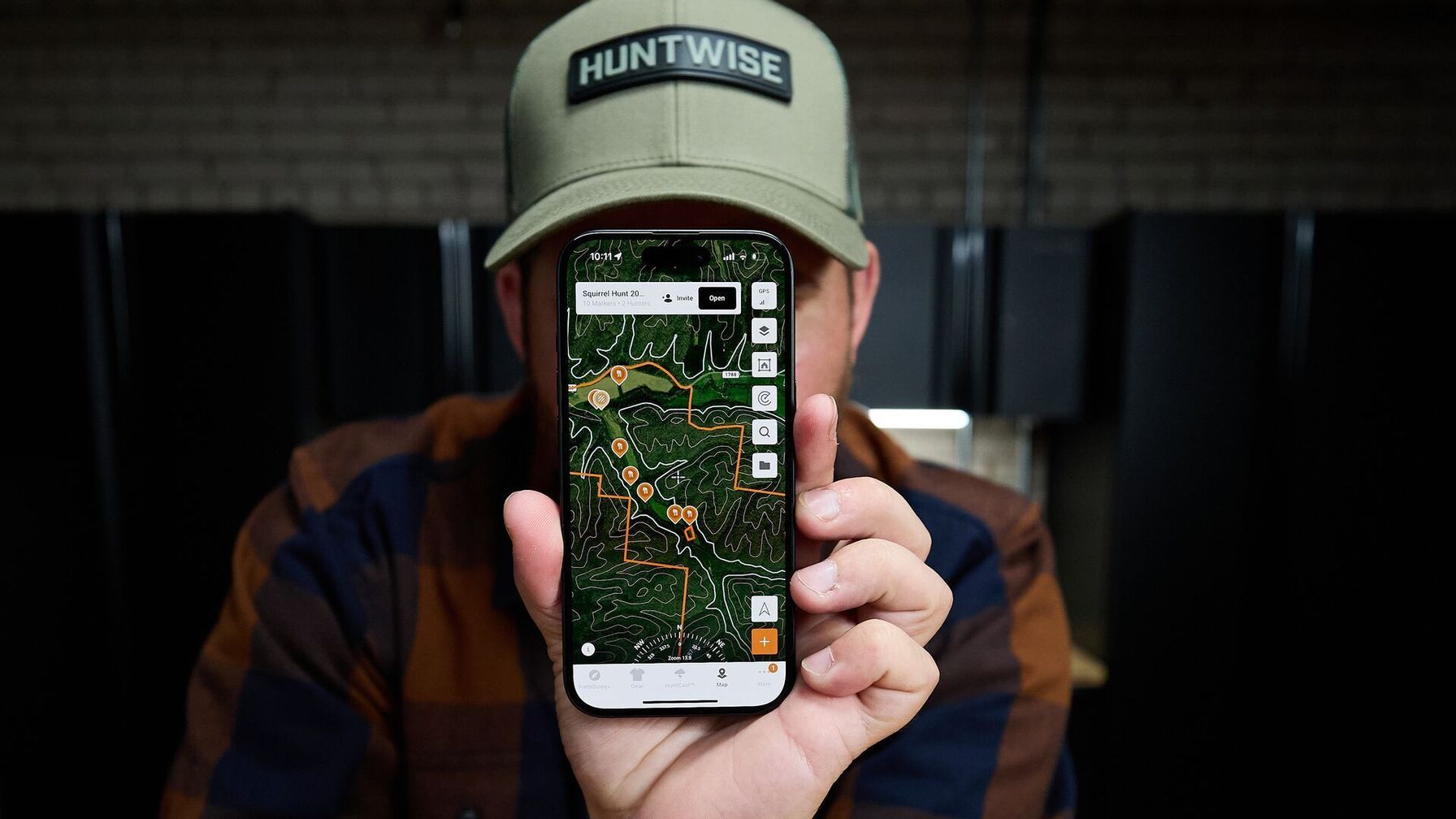
Find the Terrain Features Before You Find the Deer With HuntWise
Once you’ve mastered reading terrain on topo maps, especially saddles, benches, and pinch points, you’ll be able to plan stronger hunts and use the landscape to your advantage.
The HuntWise hybrid topo/satellite view lets you hone in on these terrain features and build a repeatable, highly effective preseason routine. Once you’ve established your preseason e-scouting flow, head into the field to confirm deer sign before setting up your stand.
Download HuntWise and explore topo maps to plan your hunt—free during your first week in the app!

Frequently Asked Questions (FAQs)
Q: What is a saddle on a topo map, and how do deer use it?
A: A saddle is a low point along a ridge between higher elevations. Deer often use saddles to cross ridges with less effort, making them potential travel corridors between drainages or areas of cover. On a topo map, look for contour lines that narrow into an hourglass or figure-eight shape.
Q: What is a bench on a topo map?
A: A bench is a relatively flat or gently sloping area along a hillside. Deer may use benches for bedding and travel because they provide a level route across steep terrain, visibility of the area below, and nearby escape routes. On a topo map, benches appear where contour lines spread apart along a slope.
Q: What is a pinch point for deer hunting, and how do I find one?
A: A pinch point is a narrow section of terrain or habitat that funnels deer through a limited route. Examples include gaps between ridges, land bridges between wetlands, and field edges that narrow into timber. On a topo map, look for areas where steep terrain, water, or openings in cover restrict movement.
Q: How is a pinch point different from a saddle?
A: A saddle is a low crossing between higher points along a ridge. A pinch point is any narrow passage that concentrates deer movement, regardless of elevation. A saddle can act as a pinch point, but pinch points can also form along creek bottoms, field edges, wetlands, and other habitat boundaries.
Q: Does HuntWise show terrain features like saddles and benches?
A: Yes. HuntWise offers topographic map layers that show elevation contours, ridgelines, drainages, and terrain features that can help you identify saddles, benches, and potential pinch points. Satellite imagery and 3-D mapping can provide additional context for understanding the terrain and planning scouting routes.
Q: What is a thermal hub on a topo map, and why does it matter for hunters?
A: A thermal hub is an area where air currents from multiple directions converge or swirl, often near intersecting drainages or ridge endings. These areas matter because changing thermal currents can carry your scent toward deer from unexpected directions. On a topo map, look for bowl-shaped terrain or several drainages that meet, then assess wind and thermal conditions before choosing your approach.
Q: How do I mark saddles, benches, and pinch points as waypoints in HuntWise?
A: Open your hunting area in HuntWise and use the topographic map layer to identify potential terrain features. Tap the map to place a custom marker, then name it descriptively, such as “north saddle” or “east bench.” Add notes about deer sign, access routes, or wind direction to help plan your in-field scouting. HuntWise supports custom markers and notes for organizing potential stand locations and other hunting spots.


