Stay on the Right Side of Every Line
View property lines in all 50 states with landowner contact info included, making it simple to request permission and plan your next hunt. With clearly marked boundaries at your fingertips, you’ll never second-guess where you stand.
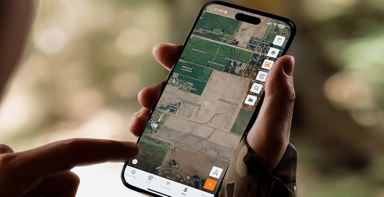
Visualize the Hunt Like Never Before
Your hunt starts with the map. Our maps deliver precision with HD satellite imagery, 3D terrain views, and over 650 map layers covering everything from contours to LiDAR. Identify bedding areas, water sources, food plots, and access routes with ease. More detail leads to better choices — and better hunts.

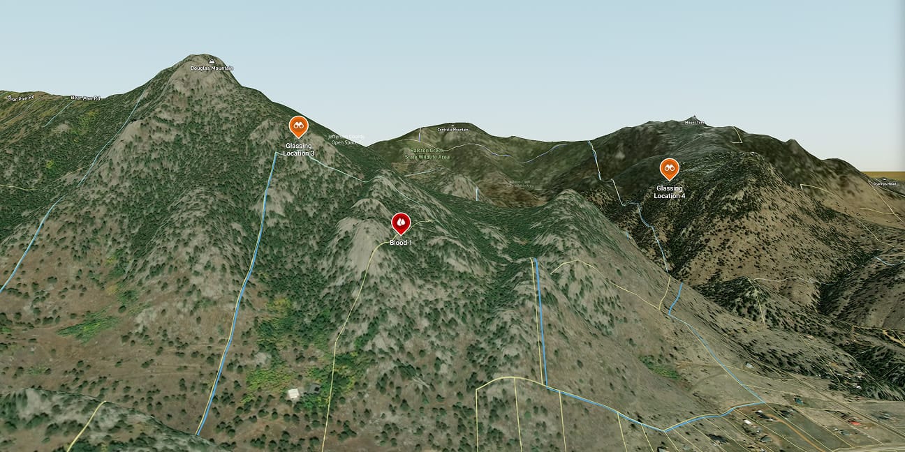
Expand Your Hunt with Public Land Maps
Discover untapped hunting opportunities near home or across state lines. With clear public land boundaries and acreage details, HuntWise helps you expand your options and maximize your time in the field.
More than a Hunting App, Your In Field Companion
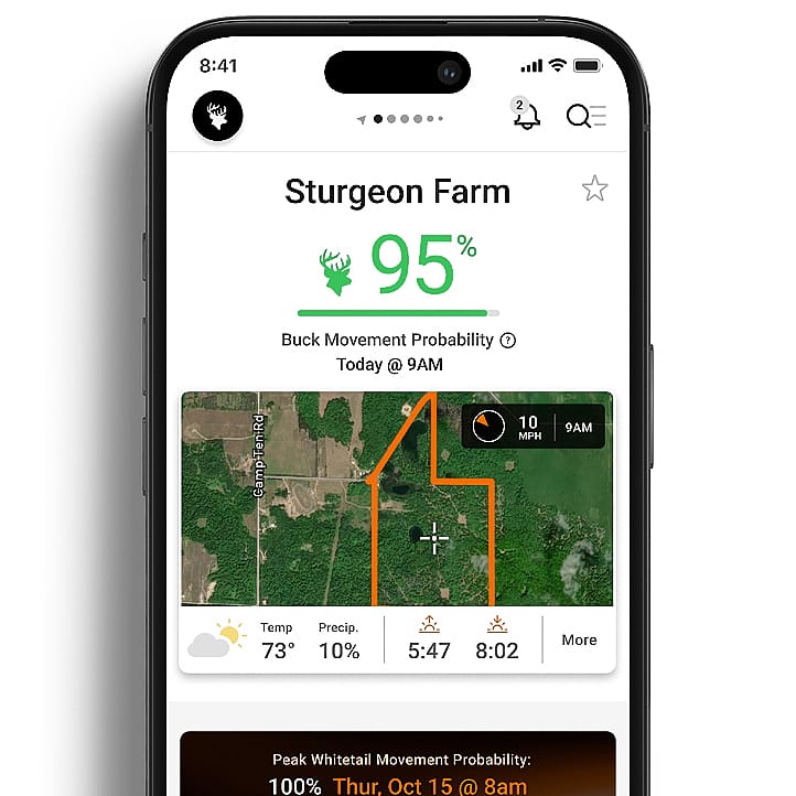
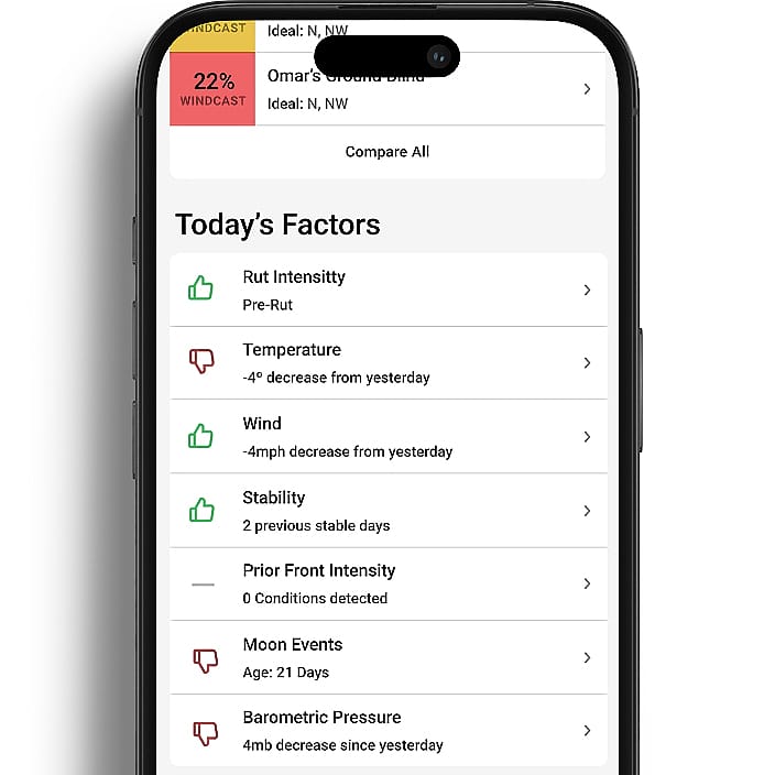
HuntCast
Get forecast to accurately predict animal movement and pinpoint peak rut timing, so every hunt is timed with purpose.
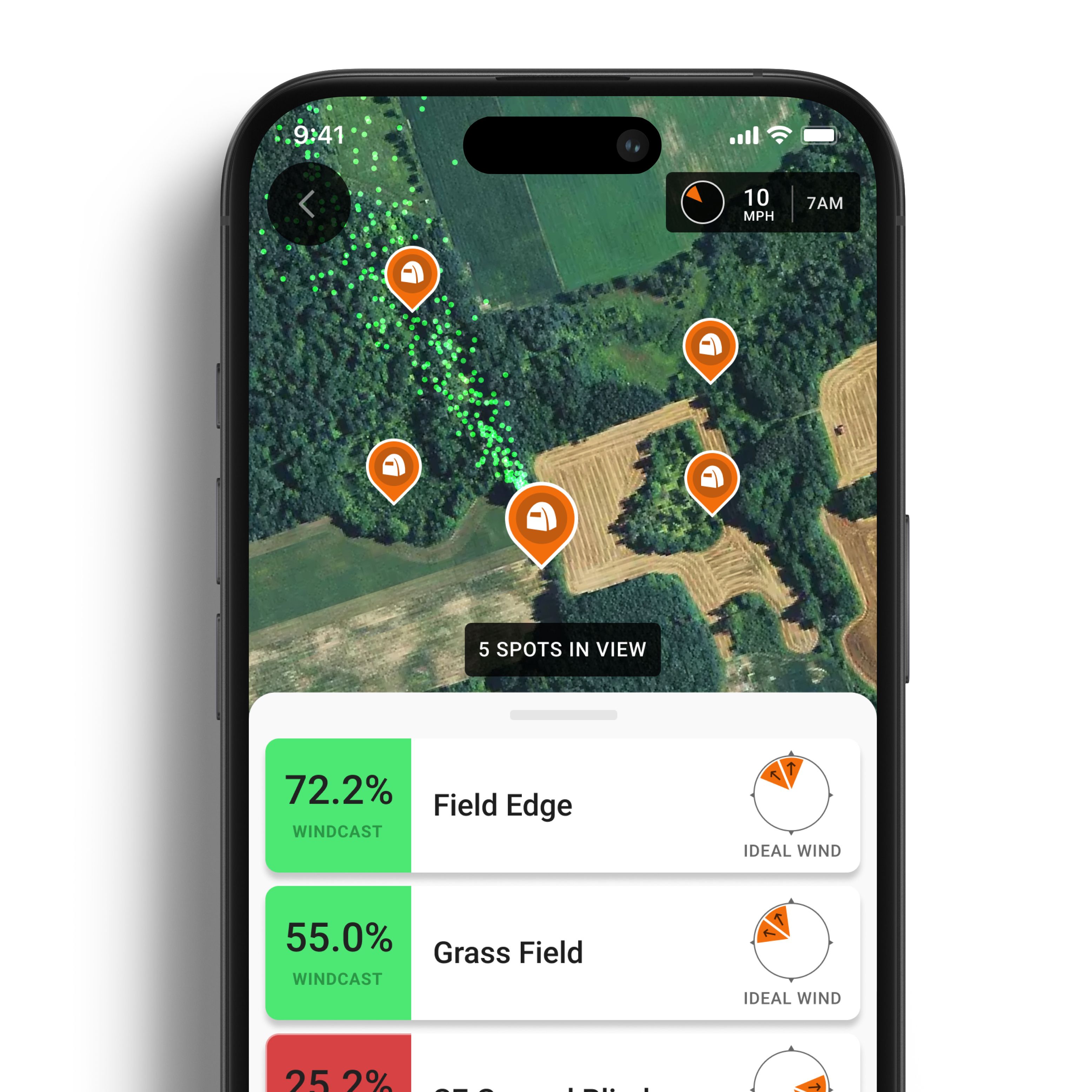
WindCast
Track real-time wind conditions to help keep your scent under control and keep you invisible in the field.
RutCast
Break down every phase of the rut with region-specific insights, so you can time your hunts when whitetails are most active.